


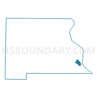
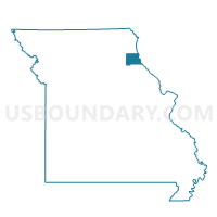
First Ward First Precinct, Marion County, Missouri
About
Outline

Summary
| Unique Area Identifier | 609081 |
| Name | First Ward First Precinct |
| County | Marion County |
| State | Missouri |
| Area (square miles) | 1.79 |
| Land Area (square miles) | 1.79 |
| Water Area (square miles) | 0.00 |
| % of Land Area | 100.00 |
| % of Water Area | 0.00 |
| Latitude of the Internal Point | 39.73685930 |
| Longtitude of the Internal Point | -91.39433890 |
Maps

Graphs
Select a template below for downloading or customizing gragh for First Ward First Precinct, Marion County, Missouri


Neighbors
Neighoring Voting District (by Name) Neighboring Voting District on the Map
- First Ward Second Precinct, Marion County, MO
- Mt. Zion Voting District, Marion County, MO
- Second Ward First Precinct, Marion County, MO